A Real Time Hidden Picture Puzzle: Solved with Jonathan Ramirez
The best way to approach a workplace injury is to prevent it from happening in the first place. Traditionally, one of the most dangerous workplace environments can be found in the construction industry. Technology is helping reduce the perilous nature in various ways, but advancements in drone functionality are drastically improving the landscape. Sean Heath sat down with Jonathan Ramirez, an account representative from Hangar to discuss the help that Hangar is providing for California’s wildfire relief, the resistance that drone deployment has to face, how repeatable programming can significantly improve project management, and what the actual future might hold for machine PLUS human collaboration.
Sean Heath: How is Hangar Technology providing assistance to officials in California as far as drone technology and helping them out during this catastrophic wildfire they’re facing?
Jonathan Ramirez: Yeah. Well, we have built an app called Hangar 360, which by the way is free and available in the App Store, but essentially it’s the most downloaded 360-degree viewer app in the entire App Store. And what it allows people to do who have a DJI Drone, which is most people have a drone, it allows them to fly that drone up and go up and capture at any altitude, a 360, in short it’s a series of 23 images that gets stitched together. It makes a pretty amazing panoramic photo.
https://twitter.com/hangartech/status/1029035644193005568
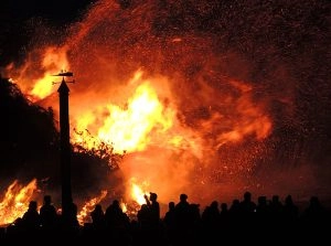
JR: So I say all of that because there are a lot of different applications for it and one has just kind of emerged on the scene in the last couple of weeks is with the Carr Fire in Mendocino County, California wildfire. What they’re doing is after the fire goes through, then they need to do some recon. Usually what they’ll do is they’ll close up the roads and so you’ve got a lot of very worried people who are wondering, “Did my house make it? What’s the state of things?” Some people left pets behind, left the vehicles behind. Essentially all of their assets are right there on the land and they don’t have the ability to go in and see it.
So through help from Menlo Park Fire District, the Alameda County Sheriff’s Department, Contra Costa Sheriff, and a bunch of other agencies, they’re able to get drones into those areas, capture these 360s which produces beautiful high-res images and they can actually check on their properties and assess damage and even identify where there might still be risks or fire to spread or worse in some cases.
SH: The best way to approach a workplace injury is to keep it from happening in the first place. And on a construction site, there are about 17 million different ways you can get hurt, not through any fault of your own, it’s a dangerous environment. And something that this 360 technology allows is it allows you to have eyes everywhere that they need to be to make sure that everybody is safe. Talk to me about how this 360-degree point of view, this perspective really contributes to safety on the work site?
JR: Yeah. Well, I will talk about the 360 and on a job site in particular, the 360 is just one of the assets that we provide to a project manager, to somebody who’s in charge of safety on the site, but the key there really is being able to capture whether it’s a 360-degree photograph or just a still image in a series around maybe the perimeter of a side of a building, right? Or even just the bird’s eye view, we call it the Bird’s Eye Orthomosaic Image. As you capture those assets, it’s really important to capture them from the same vantage point, the exact same geolocation every single time and what that allows someone who’s in charge of safety to do is really to audit what has taken place over time.
JR: There was a trench there last week and he noticed that that is more than six feet deep that is also not covered and not flagged around it. So that is a fall hazard and a fall hazard cost on average 27 grand to that company on top of making somebody’s life a living hell for a little while, while they’re healing up, right? And so letting that safety inspector see what’s happening on a weekly basis or even a daily basis in some cases allows them to identify those risks and get to them a lot faster than he would doing what they’ve typically done in the past which is drive around from site to site in a pickup truck and kind of walk through and make notes of things that they see from one single vantage point.
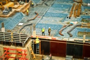
JR: That’s the vantage point that we all enjoy which is from our two eyes, you know, at eye level. Well, this one allows you to get way up higher to see from many different perspectives that you didn’t have before.
SH: Well, one of the protocols you’re using in that communication is 5G, right? I mean you guys are literally on the edge as far as communication protocol so that that data is literally real time. So we’re able to gather all of this data, we’re able to program where the drones are going to be, and we’re able to get all of the information we need, but we’re also having to deal with regulations. There’s a lot of regulations that go into using a drone in the United States and it always seems to be a moving target like it’s different today than it was last Thursday for example. How do you sort of approach that, the FAA Regulations? What do you see as being the path moving forward?
JR: Yeah. I think it’s getting better. There are plenty of advocates that have identified the benefit of drones being up in the sky doing a number of different tasks outside of the ones we’re discussing here. And so the FAA Regulation, just for anybody on the podcast that’s not familiar, is that you must maintain line of sight with the aircraft. So that means a human being has to be able to keep their eyes on that aircraft at all times in order to be compliant with Part 107 Regulations. So that’s the FAA stands today and that sounds mostly fair to pretty much anybody that seems safe. But we are entering an age where the machines and the software that are behind flying these drones have become more reliable in many cases than a human being is who’s actually piloting that drone with their thumbs. The human then becomes the point of error, not the software.
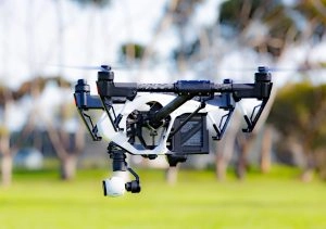
JR: And so the FAA is right now making us maintain line of sight which really gives a pilot a range of about a mile and a half, maybe two on a very clear day to actually fly that machine. But where we’re going to go I think in the future and kind of where we’re making moves toward is we’re going to remove the human from the equation. And human doesn’t necessarily have to be physically present so long as that software has a mission plan. It can actually launch the drone itself and that capability exists today by the way.
SH: Let me clarify something for listeners. Jonathan is not saying that robots are going to take over the world. He’s saying let’s put some of the tasks and responsibility on this machine that can replicate a task exactly and precisely over and over and over which then frees up the human element to help direct that machine and to help pay attention to the advancements and help create a perfect synergy between man and machine.
JR: That’s exactly right. Yeah, it’s man plus machine. I mean your automobile was made by a machine that was programmed by a human. Now there was some human touch here and there and there was great protest when those first robots came out and they took our jobs, right? But actually what it does is it created a whole other set of jobs, a new level of skill for workers to engage in where they actually become the programmers of the machines and that didn’t exist before. And so that’s kind of what I think is going happen in this space that we’re in in the near future.
For the latest news, videos, and podcasts in the AEC Industry, be sure to subscribe to our industry publication.
Follow us on social media for the latest updates in B2B!
Twitter – @AECMKSL
Facebook – facebook.com/marketscale
LinkedIn – linkedin.com/company/marketscale


