10 WAYS MICRODRONES SYSTEMS ARE BEING USED FOR BUSINESS

Unmanned aerial vehicles, particularly the totally integrated mapping solutions from Microdrones, are reinventing old ways of doing business. Whether it’s innovation in construction or new capabilities for emergency responders and precision agriculture, drones are making business operations easier in multiple industries. The Federal Aviation Administration (FAA) released rules on commercial drone usage in 2016, helping industrial applications of UAV technology to flourish. Here’s how the team from Microdrones is changing the game.
1. HELPING TO MANAGE CONSTRUCTION SITES:
Direct georeferencing systems, such as the mdMapper1000 DG, can precisely map corridor projects such as roads, canals, pipelines, and other linear infrastructure. Drones can efficiently monitor progress and track volumes and stockpiles, and can create real-time project overviews for better safety, planning, and collaboration. Improved job tracking reduces labor and materials waste for construction companies.
2. DETECTING METHANE IN GAS PIPELINE INFRASTRUCTURE AND LANDFILLS:
Methods for detecting gaseous hazards, specifically methane, have transformed drastically over the years. The mdTector1000 CH4 from Microdrones is an aerial methane inspection package that employs an unmanned drone and a Pergam gas sensor to provide safe, reliable, and cost-effective methane detection. The hardware is fully integrated with easy-to-use tablet software that makes it easy to plan a mission, fly it, and visualize the methane spots in both real-time and post-flight.

3. SURVEYING FLOOD ZONES:
Direct georeferencing (DG) is a method of connecting aerial images to their position on the Earth and putting them together in the most precise possible order to reduce the time surveyors must spend on mapping projects. In many cases, DG reduces or eliminates the need to install ground control points (GCPs). The Riverside County Flood Control and Water Conservation District, RCFC&WCD, recently tested the mdMapper1000DG on their project. With the UAS system, the team drastically reduced its field time investment while also cutting aerial flight costs.
4. PRECISION AGRICULTURE AND FARMING:
Interesting research examining mole activity in France was carried out with a Microdrones UAV, equipped with different payloads for acquiring data (camera, multispectral, thermal and LiDAR).

5. MAPPING SOLAR STRUCTURES WITH UAS:
Using a Microdrones md4-1000 UAS equipped with optical and infrared sensors, The Institute of Solar Research of the German Aerospace Center completed their first successful flight over a solar power plant back in 2014. They now fly between 50 and 100 missions per year using a Microdrones system.
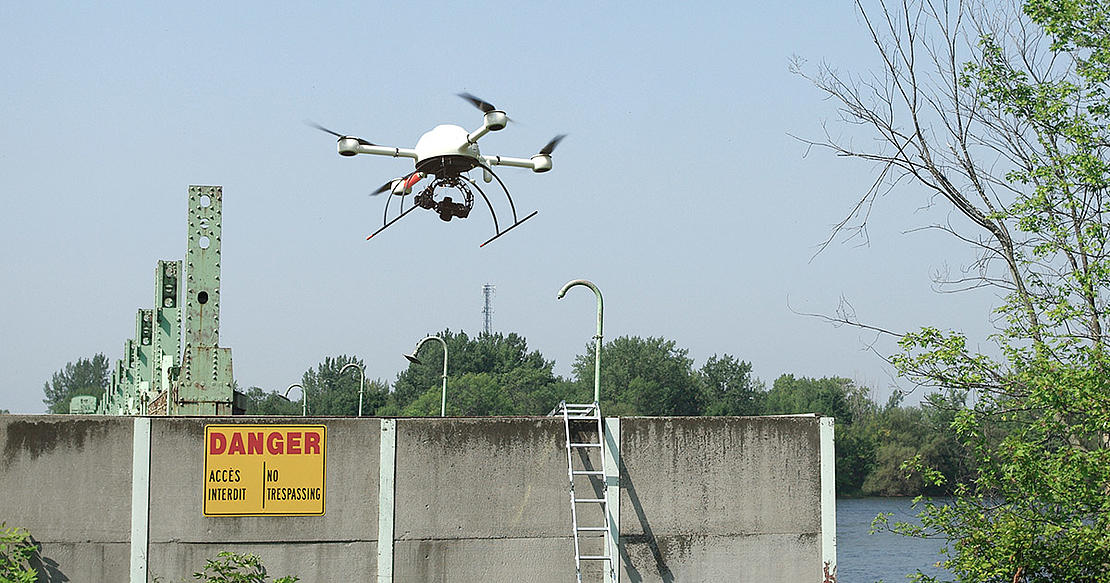
6. INSPECTING STRUCTURES THAT ARE DIRTY, DANGEROUS OR DIFFICULT TO REACH:
There are many success stories of using drones for aerial mapping, one of which is mapping a full dam in Canada. Because of hazards, it was prohibited to establish GCP’s on the dam, yet there was a necessity to map and analyze the structure. A few hours of flying and data processing produced a pointcloud mapping product. It was the perfect solution for the job.
7. CORRIDOR MAPPING ROADS:
Corridor mapping is frequently used by utility or transportation companies to assess an area where new infrastructure such as power lines or train tracks need to be built. As the global demand for energy grows, a fast and accurate method of surveying old infrastructure, and planning for new, is needed. Corridor mapping allows this to be done far faster and with less man power than traditional survey systems.
8. PREDICTING AVALANCHE RISK:
Microdrones recently flew its mdMapper package equipped with a LiDAR payload at a national park in Quebec. The system was used to quickly and accurately measure snow depth to better predict the risk of an avalanche.
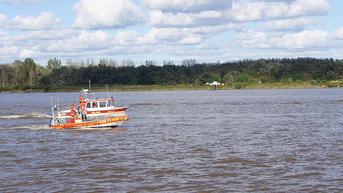
9. IMPROVING GROUND RESCUE OPERATIONS:
Four companies conducted a joint field trial at Horneburg near Hamburg on the shores of the river Elbe. During the trial simulation, it was shown how a child could be rescued using a specially equipped Microdrones md4-1000. Because the flight took place outside of the drone operator’s range of visibility, the Microdrones UAV was equipped with a thermal imaging camera as well as a specially developed cellular radio module.
10. PROVIDING GEOSPATIAL DEALERS WITH INNOVATIVE NEW TECHNOLOGY LIKE UNMANNED AERIAL LIDAR:
Geospatial pros demand fast and effective ways to capture elevation data with extreme accuracy. The ability to penetrate foliage makes LiDAR the most versatile tool for elevation mapping, so Microdrones applied R&D to an end-to-end drone-based LiDAR mapping package, with Direct Georeferencing for capturing LiDAR elevation points for professional mapping.
Let us know what kind of application you have in mind. Our team would love to help you select the right solution. Start a conversation with us today!
Read more at microdrones.com