Drone LiDAR Documentary Show Makes Some Waves in the Louisiana Marsh

Rome, NY- Down to Earth, a surveying reality series, journeys into the remote wilderness of the Southern Louisiana wetlands, to follow surveying and engineering firm, Morris P. Hebert, Inc. (MPH,) as they use drone surveying equipment from Microdrones to verify fill levels in a marsh restoration project.
The next 3 new episodes are set to premiere Wednesday, May 26, 2021. Viewers can register to watch at either 9am ET or 6pm ET at the following link: CLICK HERE.
“Down to Earth” is a reality series that shows how real surveyors collect data and turn it into real deliverables, despite challenging terrain, rough weather, and hidden dangers.
For this project, we learn that coastal Louisiana faces some of the highest land loss rates in the world due to both natural and manmade factors. To help prevent further land erosion, extensive coastal protection and restoration plans are underway. Part of these efforts include marsh creation projects, to quickly restore wetlands, expand habitats and help prevent future land loss.
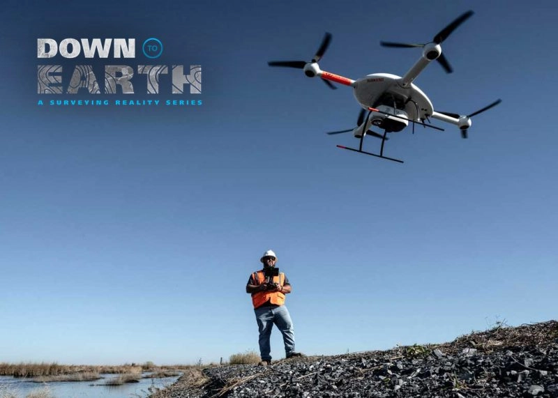
MPH was tasked with surveying over 200 acres of a marsh restoration project to analyze pre and post conditions. They’ll need to determine if quantities of fill material meet the design specifications that were set forth for the restoration. This 3-part series of Down to Earth follows the MPH team as they deploy drone LiDAR and the use of an airboat to conduct the survey with minimal environmental disturbance.
The first episode introduces the MPH Surveying team of Dakota Dagenhardt, an Environmental Regulatory Specialist and Kiley Cressionie, a Remote Sensing Tech, as they give an overview of the project and discuss some of the challenges they face.
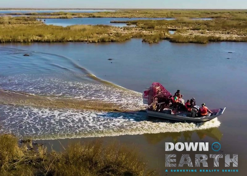
In Episode 2 Dagenhardt and Cressionie utilize the assistance of an airboat to help keep tabs on the drone LiDAR system as it flies over the extensive marsh.
“Our survey area extends to over 1,000 meters away from our launch site,” Cressionie explains. “While we can maintain line of sight, it’s better to have a visual observer in closer proximity to the drone and in
constant communication with the pilot. The airboat gets us out to the edge of our survey area with relatively little environmental disruption.”
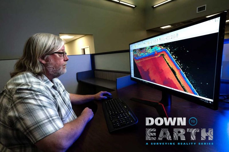
The final episode in the series is set in the Houma, Louisiana offices of MPH, where their R&D and Training Coordinator, Lee Drennan, processes and visualizes the LiDAR data to create a point cloud and orthophoto of the marsh restoration project.
“We’ve used the mdLiDAR3000 for landfills, construction projects, and marsh restoration areas,” Drennan said, “because the LiDAR really lends itself to anything involving volume calculation. Not only can we do the project faster and more efficiently, but we can provide a better product, since the LiDAR point cloud is so dense.”
About Morris P. Hebert, Inc.
Morris P. Hebert, Inc. (MPH) offers professional services, complete with experienced and knowledgeable personnel and state of the art equipment, to assist clients with the successful execution and completion of their engineering and construction projects. MPH is committed to providing client focused solutions. MPH project management, engineering, surveying, field services, GIS, and environmental services groups can be provided on a turn-key or individual basis, as dictated by the client and project requirements.
With nearly 40 years in the business of providing professional services, MPH is grateful to their many clients the opportunity to participate in the successful completion of numerous engineering and construction projects. MPH is one of the more talented and multifaceted engineering service companies in the Gulf Coast. With offices in Houston, TX, San Antonio, TX, Midland, TX, and Houma, LA, MPH is strategically positioned to assist clients with their professional service needs.
MPH’s success is grounded in the ability to work closely with clients in developing cost effective solutions and real world answers to complex surveying and engineering problems. MPH is able to respond quickly and effectively to ever changing project situations and demands and maintain an uncompromising commitment to safety and the environment. Their goal is to deliver on time and on budget.
About Microdrones
Microdrones grew out of the collaboration between the German inventor of the world’s first commercial quadcopter and a determined surveying payload and software developer in North America. The result is a global aerial mapping technology company that delivers complete and reliable mapping systems specifically developed for the surveying, mining, construction, oil & gas and precision agriculture industries.
Microdrones Integrated Systems are industrial tools addressing specific complex mapping challenges for professional customers, relying on a fully integrated geospatial workflow that enables cutting-edge software technology from Microdrones to transform raw data collected in the field by Microdrones survey equipment into valuable high-quality survey-grade data. Microdrones is widely recognized for its LiDAR technology leadership.
Microdrones has engineering centers and manufacturing facilities in Germany, Canada, France, China and the United States, as well as a sales, support and distribution network spanning six continents.
Microdrones serves markets around the globe. To learn more about Microdrones, visit www.microdrones.com or follow @Microdrones on Facebook, LinkedIn, or Twitter.