Articles by tag: Microdrones
Caulfield & Wheeler, Inc. is celebrating 40 years of providing professional civil engineering, planning, land surveying, and landscape architecture services throughout Southeastern Florida. They pride themselves on utilizing the most recent technology available on the market, to maintain their competitive edge in order to provide clients with the most proficient and cost-effective designs using point…
Latest
Articles
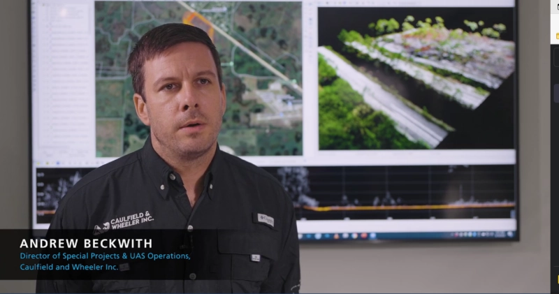
Down to Earth: Point Clouds to Paradise – Episode 2
Caulfield & Wheeler, Inc. is celebrating 40 years of providing professional civil engineering, planning, land surveying, and landscape architecture services to make Southeastern Florida a paradise. They pride themselves on utilizing the most recent technology available on the market, to maintain their competitive edge in order to provide clients with the most proficient and cost-effective…
Articles
Down to Earth: Point Clouds to Paradise – Episode 1
Caulfield & Wheeler, Inc. is celebrating 40 years of providing professional civil engineering, planning, land surveying, and landscape architecture services and making Southeastern Florida a paradise. They pride themselves on utilizing the most recent technology available on the market, to maintain their competitive edge in order to provide clients with the most proficient and cost-effective…
Articles
Down to Earth: Land, Sea, and Air – Episode 3
The Pearl River cuts through the heart of Jackson, Mississippi, and also provides drinking water to hundreds of thousands of residents. However, the water source can also pose a threat to the local community when the levels flood. In this third episode of Down to Earth: Land, Sea, and Air by Microdrones, Mississippi D-O-T is…
Articles
Down to Earth: Land, Sea, and Air – Episode 2
The Pearl River cuts through the heart of Jackson, Mississippi, and also provides drinking water to hundreds of thousands of residents. However, the water source can also pose a threat to the local community when the levels flood. In this second episode of Down to Earth: Land, Sea, and Air by Microdrones, the Mississippi D-O-T…
Articles
Down to Earth: Land, Sea, and Air – Episode 1
The Pearl River cuts through the heart of Jackson, Mississippi, and also provides drinking water to hundreds of thousands of residents. However, the water source can also pose a threat to the local community when the levels flood. In this episode of Down to Earth: Land, Sea, and Air, a Microdrones podcast, Mississippi D-O-T is…
Articles
Using Drone LiDAR to Complete an As-Built Survey
Rome, NY- Traditionally, the documentation of As-Built construction surveys relied on conventional methods such as total stations and digital photogrammetry. However, the team at Spatial Data Consultants (SDC), an expert geospatial consulting firm in High Point, North Carolina, is using drone LiDAR technology to more efficiently create accurate and precise As-Built Surveys. CLICK HERE and…
Latest

Leverage Data-Driven Tools and Local SEO for Maximum Search Engine Rankings
As businesses continue to navigate the digital landscape, data-driven tools are more crucial than ever for effective SEO strategies. Understanding and implementing the proper SEO practices can make a significant difference with evolving algorithms and competitive markets. Given that 75% of users never scroll past the first page of search results, this statistic underscores…

On-Device AI is Today’s Tech Innovation, Competition and Market Leadership Driver
On-device AI revolutionizes the tech landscape, making it a critical factor for industry dominance. This cutting-edge technology directly integrates advanced AI capabilities into devices, transforming consumer and enterprise applications. This shift stems from the need for improved performance, reduced latency, enhanced data privacy & security, and personalized user experiences. With advancements in neural processing…

The Role of AI in Modern Supply Chains: Insights from Aaron Hatfield at Arvist
Artificial intelligence rapidly transforms modern supply chains, with companies like Arvist leading the charge. In a recent episode of Hammer Down, hosted by Mike Bush, Aaron Hatfield, the Head of Sales at Arvist, sheds light on AI’s practical applications and benefits in enhancing supply chain operations. Is AI in the supply chain a double-edged…

Training New Semiconductor Manufacturing Professionals is Key to Meet Coming Domestic Manufacturing Demand
Over the past few years, the U.S. has made significant strides in semiconductor manufacturing, driven by substantial investments and strategic policies. With the CHIPS Act expected to triple domestic semiconductor manufacturing capacity by 2032, the need for a skilled workforce is more urgent than ever. This discussion explores the key question: What does the…