Down to Earth, a Surveyor Reality-TV Style Series, Premieres the Challenges of Surveying the Great Pit in Falun, Sweden

Rome, NY- “Down to Earth,” a surveying reality series that shows how real surveyors collect data and turn it into real deliverables, despite challenging conditions, rugged terrain and possible dangers, is set to premiere 3 new episodes Wednesday, February 17, 2021. Viewers can register to watch at either 9am ET or 6pm ET at the following link: CLICK HERE
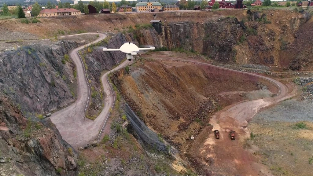 The mdLiDAR3000DL aaS flying over the Great Pit in Falun Sweden
The next 3 episodes, titled “The Great Pit” will take viewers on an exciting journey alongside engineering and surveying firm SWECO. Watch as they attempt to survey and map the historic Falun Mine, in Sweden, once the world’s largest copper producer, to identify movement or settlements that could lead to a collapse.
This premiere will feature the 3 episodes of Down to Earth, The Great Pit, along with exclusive behind-the-scenes mission planning, data capture and analysis of the final deliverables narrated by the professionals involved in the project.
The first episode introduces the Sweco surveying team, both named Johan Larsson but unrelated, along with Rikard Svall, chief survey specialist for 5D Teknik, the distribution partner for Microdrones in Sweden, who provided additional support during the mission.
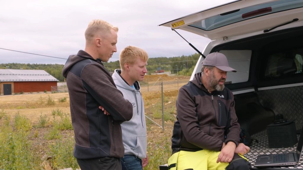 Johan Larsson, a surveying engineer from Sweco, Rikard Svall, chief survey specialist for 5D Teknik, and Johan Larsson, a surveying engineer from Sweco, examine data collected in the field from drone surveying equipment.
“The Falun Mine has become a popular tourist attraction,” explains Larsson. “Our client wants to identify possible danger zones so they can take action to keep people safe. However, there are parts of this mine that are very difficult and dangerous to reach for a land surveyor. Using the Microdrones mdLiDAR3000DL aaS, we can get highly accurate point clouds in dangerous areas and we’re able to collect data we couldn’t get to before.”
“At this open pit mine, it’s almost impossible to complete this survey using traditional methods,” Svall reiterated. “It’s very dangerous to be inside the actual pit or next to the pit. No one wants to expose their staff to hazardous conditions like cave-ins or ground collapses. This is a perfect mission to utilize drone surveying equipment from Microdrones.
For Episodes 2 and 3 you’ll follow the Sweco team into the depths of the Great Pit and back to their office to view the data find out if the mission succeeded.
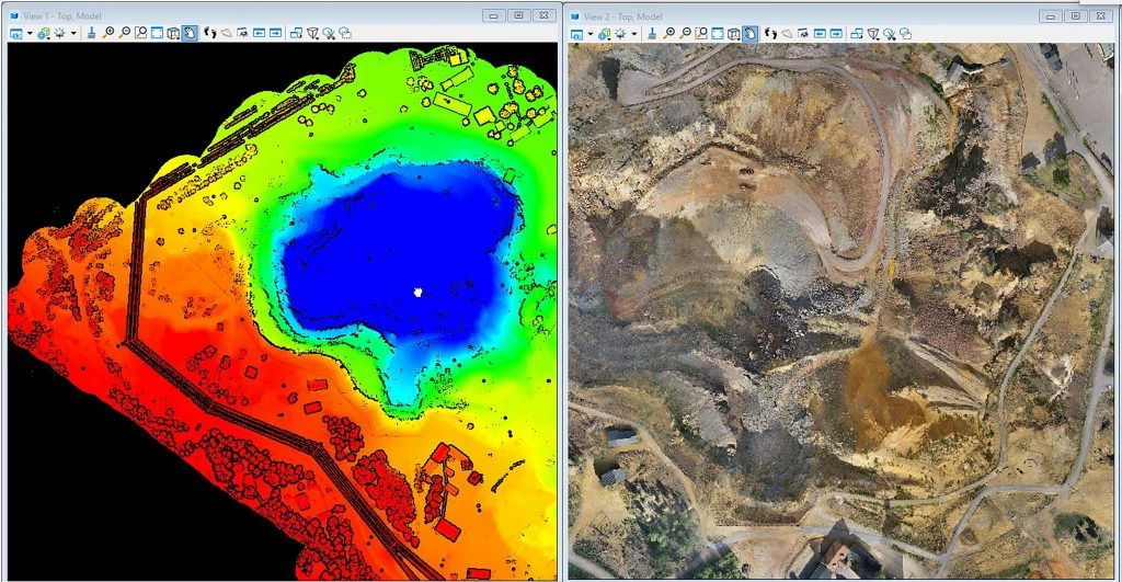 Data collected helps to visualize a LiDAR point cloud of the Great Pit on the left and an orthophoto of the area on the right.
“It was exciting to bring our Down to Earth Series to Europe and work alongside both our distributor and customer,” said Microdrones Marketing Director Mirjam Bäumer. “The mission at the Falun Mine exemplifies why drone surveying equipment can keep surveyors safe and get the job done much more efficiently. Plus, I think the episodes make for great viewing. It’s a beautiful Swedish landmark that poses challenges and safety hazards for our customer. All the perfect ingredients to make a dramatic reality surveying series. Can they overcome these obstacles using drone surveying equipment from Microdrones? Watch and see! I hope you enjoy our next episodes of Down to Earth.”
In “The Great Pit,” watch as the team digs deep and flies high to cover the challenging terrain, keep safe, and collect the data required to analyze safety concerns at the Falun Mine.
About Microdrones
Microdrones grew out of the collaboration between the German inventor of the world’s first commercial quadcopter and a determined surveying payload and software developer in North America. The result is a global aerial mapping technology company that delivers complete and reliable mapping systems specifically developed for the surveying, mining, construction, oil & gas and precision agriculture industries.
Microdrones Integrated Systems are industrial tools addressing specific complex mapping challenges for professional customers, relying on a fully integrated geospatial workflow that enables cutting-edge software technology from Microdrones to transform raw data collected in the field by Microdrones survey equipment into valuable high-quality survey-grade data. Microdrones is widely recognized for its LiDAR technology leadership.
Microdrones has engineering centers and manufacturing facilities in Germany, Canada, France, China and the United States, as well as a sales, support and distribution network spanning six continents.
Microdrones serves markets around the globe. To learn more about Microdrones, visit www.microdrones.com or follow @Microdrones on Facebook, LinkedIn, or Twitter.
# # #
Link to watch premiere: https://lp.microdrones.com/down-to-earth-season-2/?utm=marketscale
Captions:
- The mdLiDAR3000DL aaS flying over the Great Pit in Falun Sweden
- Johan Larsson, a surveying engineer from Sweco, Rikard Svall, chief survey specialist for 5D Teknik, and Johan Larsson, a surveying engineer from Sweco, examine data collected in the field from drone surveying equipment
- Data collected helps to visualize a LiDAR point cloud of the Great Pit on the left and an orthophoto of the area on the right.