Articles by tag: Aerial Survey

GEO Week is set to take flight in just a couple of days and the show’s exhibit floor is sold out, even with the lingering Omicron challenges, meaning the UAV and Survey industries ares amped to get back to business and share in a year+ of massive industry movement and validation for drones. We […]
Latest
Articles
Using Drone LiDAR to Complete an As-Built Survey
Rome, NY- Traditionally, the documentation of As-Built construction surveys relied on conventional methods such as total stations and digital photogrammetry. However, the team at Spatial Data Consultants (SDC), an expert geospatial consulting firm in High Point, North Carolina, is using drone LiDAR technology to more efficiently create accurate and precise As-Built Surveys. CLICK HERE and […]
Latest

Cybersecurity Risks and Patient Risks are at a Crossroads as Tech Moves Rapidly
The current digital transformation reshaping healthcare is standing out not only for its rapid adoption of technology, but also for the unique challenges it’s facing in balancing its cybersecurity risks and patient risks. Healthcare systems increasingly rely on interconnected technologies and AI, but the stakes of maintaining tight security measures are incredibly high now. […]

Healthcare Orgs, Take Control of Your Network! Level Up Cyber Hygiene with Diligent Vendor Vetting and Software Segmentation.
The digital transformation of healthcare organizations has significantly increased reliance on software and medtech devices, weaving a complex web of interdependencies in their supply chains. This shift raises critical vulnerabilities as highlighted by infamous incidents like the SolarWinds breach, underscoring the urgency for enhanced cyber hygiene practices. With recent executive orders pushing for better […]
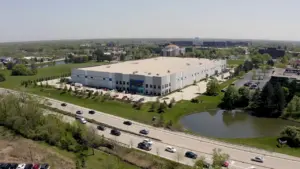
Tour Benchmark Products: Pioneering Cleanroom Solutions for Life Sciences
Get a feel for Benchmark Products cleanroom solutions for life sciences manufacturing customers with this mini tour of their facility.

Benchmark Products Bioprocessing Solutions Provide Single-Use Solutions for Customers
Benchmark provides a new bioprocessing solution to maximize efficiency. This is a single-use system for pharma manufacturers for filling, mixing and single-use assemblies.