Using Drone LiDAR to Complete an As-Built Survey

Rome, NY- Traditionally, the documentation of As-Built construction surveys relied on conventional methods such as total stations and digital photogrammetry. However, the team at Spatial Data Consultants (SDC), an expert geospatial consulting firm in High Point, North Carolina, is using drone LiDAR technology to more efficiently create accurate and precise As-Built Surveys. CLICK HERE and see how to become drone survey experts, in these all new episodes of Down to Earth, Spatial Experts.
“Down to Earth” is a documentary-style reality series that shows how real surveyors collect data and turn it into real deliverables, despite challenging conditions, hidden dangers, and inclement weather.
In this 1st episode, Mark Schall, Owner and Chief Professional Officer at Spatial Data Consultants explains how the company has transitioned from using manned fixed wing and helicopter aircraft to drone surveying systems. “Initially the company was based off traditional photogrammetry using fixed wing and helicopter aircrafts,” said Schall. “We’ve now transitioned into drone and UAS systems for all of our Lidar and photogrammetry. The one thing we pride ourselves on is the level and competence and expertise we have in our personnel, like Fred Johnson, our current director of UAS Services.”
The episode continues with a brief analysis of a previous drone LiDAR point cloud created by SDC, before Fred walks through the planning process for an As-built Survey they will conduct with drone LiDAR for the new entrance at High Point University in North Carolina.
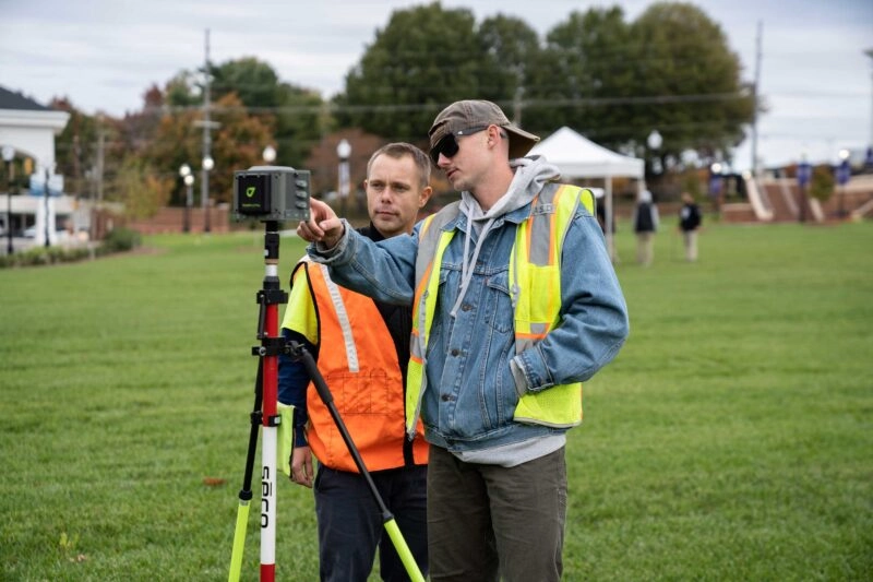
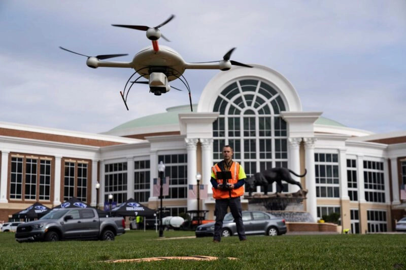
Episode 2 sees the SDC team set up and fly a corridor surveying mission at the new entrance to High Point University. “We decided to do a corridor mission because the main focus was the new roadway leading into the campus,” explained Johnson. “I expect all of the details needed for the As-Built Survey to be clearly visible in my point cloud and photography.” Utilizing the mdLiDAR3000 from the Microdrones expert drone line, SDC will be able to deliver the planimetrics, topographical features and other construction structures to make sure that all of the improvements on Panther Drive were constructed in accordance with the original design specifications. However, during the As-Built Survey, the team ran into some unanticipated challenges in ground traffic and an open road-way.
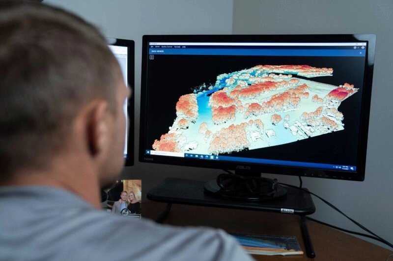
The third episode takes place back at the office of Spatial Data Consultants, where Fred processes the data to visualize the utilities, structures, and other construction features of the project in a LiDAR point cloud. Using mdInfinity, a complete software solution for Drone LiDAR, and other 3rd party software, Johnson will see if he can successfully create the As-Built Survey and deliver the project.
The series concludes with the fourth episode set in a local bottle shop, where the team reviews the project, workflow, and shares their final thoughts and insights all while enjoying a cold beverage.
About Spatial Data Consultants
Spatial Data Consultants, Inc. (SDC) is a Small Business Enterprise (SBE); Small Professional Services Firm (SPSF); North Carolina Corporation; based in High Point, NC and is a responsible full service professional organization specializing in offering a broad variety of Photogrammetry, Surveying, Remote Sensing and GIS related services. Founded in 1996, SDC was established with the goal of satisfying the unique and specific requirements of each potential client, providing intimate service, while stressing not only quality in planning and products, but sound management and consulting.
About Microdrones
Microdrones grew out of the collaboration between the German inventor of the world’s first commercial quadcopter and a determined surveying payload and software developer in North America. The result is a global aerial mapping technology company that delivers complete and reliable mapping systems specifically developed for the surveying, mining, construction, oil & gas, and precision agriculture industries.
Microdrones Integrated Systems are industrial tools addressing specific complex mapping challenges for professional customers, relying on a fully integrated geospatial workflow that enables cutting-edge software technology from Microdrones to transform raw data collected in the field by Microdrones survey equipment into valuable high-quality survey-grade data. Microdrones is widely recognized for its LiDAR technology leadership.
To learn more about Microdrones, visit www.microdrones.com or follow @Microdrones on Facebook, LinkedIn, or Twitter.