MICRODRONES GOES BIG WITH RELEASE OF MDLIDAR3000, AS WELL AS TWO NEW MDMAPPER SYSTEMS

Las Vegas, Nevada- Announced today at the Commercial UAV Expo was the launch of the new mdLiDAR3000. It’s the newest LiDAR system from Microdrones that combines the heavy lifting power of the md4-3000 drone with a RIEGL LiDAR and a SONY camera for rapidly producing colorized pointclouds.
The new system is unique because it takes advantage of the robust power of md4-3000, the largest Microdrones aircraft which can carry more, fly longer, and reach higher. High payload capacity makes it ideal for handling heavy LiDAR sensors, advanced mapping grade cameras, and multiple sensors and provides the robust platform for heavy duty LiDAR geomatics.
The entire integrated system enables the user to quickly acquire high density, accurate LiDAR data in the field and quickly turn it into a 3D colorized pointcloud via popular software. Microdrones President Vivien Heriard-Dubreuil explains how his team got to this point. “Last year, we led the field with the development of mdSolutions like the mdMapper1000DG, the mdTector1000CH4 and our mdLiDAR1000. The new mdLiDAR3000 is the next step in our evolution. Geospatial pros always demand a faster, more effective way to capture elevation data with extreme accuracy. We are very pleased to be the company that can empower them with a powerful new tool to do just that.”
Dr. Mohamed Mostafa, Director of Microdrones mdSolutions is very excited about the product. “The mdLiDAR3000 has been in development for the past three years and this system is revolutionary. Our md4-3000 is the ideal platform to integrate with the RIEGL miniVUX-1UAV LiDAR. The results capable via our integrated system and easy workflow are very impressive and I will be revealing them at my presentations this week.”
Mike Hogan, Microdrones Sales Director anticipates a high demand for mdLiDAR3000. “We put a lot of effort, time and resources into designing this system and it’s very rewarding to see this come to fruition. This is a serious machine for serious geomatics professionals in the construction, land development, engineering and geomatics trades.”
In addition to this new flagship LiDAR product, the Microdrones team has added new systems to round out its mdMapper lineup: mdMapper1000PPK and mdMapper1000+.
As review, each of the now five mdMapper systems is outfitted to deliver turnkey aerial surveying, mapping, data collection, tailored to the needs of the customer, ranging from the mdMapper1000DG to the entry level, aerial mapping package in the mdMapper200. Our top-line entry, mdMapper1000DG, uses direct georeferencing where customers are able to save time by using fewer or no ground control points for less sidelap and more productivity. Hogan explains, “Although not all of our customers may need the power of direct georeferencing just yet, they all need highly accurate and precise data collection. That’s where the mdMapper1000PPK provides high accuracy with just 1-3 ground control points.” Furthermore, down the road, when a business is ready to expand to DG, the mdMapper1000PPK is easily and affordably upgradeable via the DG READY firmware update.
At an even lower price point comes the new mdMapper1000+. This system is ideal for those who do not need DG or PPK and are willing to install ground control points on site for their projects. Hogan explains, “Customers who frequently fly the same site repeatedly find this to be an adequate solution. Best of all the mdMapper1000+ is ready to expand with the user. It’s both PPK ready and DG ready with a practical and affordable firmware upgrade.”
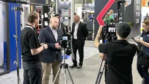
The Microdrones team encourages attendees at the Commercial UAV Expo to visit the Microdrones booth to learn more, or check out our detailed web pages here.
About Microdrones
Founded in Germany in 2005, Microdrones developed the world’s first commercial quadcopter and the company continues to lead the industry with their professional UAV solutions.
By pairing robust drones with cutting-edge sensors, Microdrones offers advanced turn-key solutions that make it easy for businesses to start using UAVs for surveying, mapping, construction, inspection, precision agriculture, mining, and other commercial applications. A heritage of quality German engineering, extra-long flight times, resistance to environmental challenges, and technology like direct georeferencing make Microdrones solutions exceptionally safe, efficient, and cost-effective choices for commercial users.
Microdrones serves markets around the globe. To learn more about making a Microdrones system a part of your professional work, schedule some time with our friendly, helpful sales experts.
Read more at microdrones.com